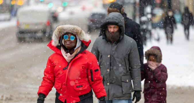
On the tail end of a polar blast followed by a massive winter storm that has hit over 200 million people across the country and covered the Chicago area with several inches of snow, officials warn that the extreme weather won’t let up, even if the snowflakes stop falling as forecast by early Sunday evening.
Between midnight and noon on Monday, Cook County will again experience “dangerously cold” wind chills as low as minus 20 degrees, and even colder away from the lake.
People with exposed skin could experience frostbite in as little as 30 minutes, so experts urge staying indoors, and say those who must go outside should dress in several layers, including a hat, face mask and gloves.
As of Saturday, the Chicago area had received 24.5 inches of snow this season, compared to a normal of almost 18 inches by this date, according to the latest National Weather Service data.
The seasonal total will be even higher after Sunday’s snowfall ends: By the afternoon, snow accumulation totals ranged between 2 and 8 inches of snow in the city and surrounding suburbs, according to a map of local reports from the NWS. Nonetheless, it likely won’t come close to the 73.6 inches accumulated by this date in the winter of 1978-79, which was the snowiest on record for the area, with a final tally of 89.7 inches.
Related Articles
Great Lakes ice resurges this winter, but unpredictable shifts threaten businesses and ecosystem
A snowy, cold start to winter follows a very warm fall. How are Illinois seasons changing?
Will trees ‘explode’ during this cold snap? Illinois arborists weigh in.
Lake-effect snow like this weekend’s occurs when cold air moves across the open, warm water of the Great Lakes, picking up heat and moisture. Made less dense, the air then rises, cools and condenses into clouds, which produce heavy snow in narrow bands downwind.
After years of little snow across the Chicago area, record-breaking snowfall and below-freezing temperatures earlier this winter — as well as the weekend’s massive storm — might seem to contradict scientific reports of winters getting warmer.
But trends in recent decades point to an overall warming of average temperatures across all seasons from human activities such as fossil-fuel burning that release heat-trapping gases into the atmosphere. And that overall warming doesn’t rule out some occasional outliers, including extreme cold and winter storms.
These usually occur because of a weakened polar vortex, which is a constant cold, low-pressure system of air circulating counterclockwise around both of the Earth’s poles like a wall that contains cold air.
When unstable, the polar vortex can cause the jet stream — a band of strong wind that generally travels from west to east and acts as a boundary between cold, polar air and warmer air farther south — to buckle, sending bitterly cold air from the Arctic southward into North America.
Chicago Tribune’s Christy Freitag contributed.
https://www.chicagotribune.com/2026/01/25/chicago-cold-snow-polar-vortex/