
Polar vortexes are a year-round phenomenon. But Chicago-area residents only notice them when they collapse, experts say.
That’s what’s happening starting Thursday when dangerously frigid air from Siberia and the North Pole is forecast to plunge the Great Lakes region into subzero territory for multiple days.
“A piece of (the polar vortex) will break off and meander southward into our area,” said Gino Izzi, a senior meteorologist with the National Weather Service.
The National Weather Service has issued an extreme cold watch from 4 a.m. Thursday until noon Friday for Chicago as well as central, north central and northeast Illinois, said NWS Chicago meteorologist Zachary Yack.
The most severe stretch will occur Thursday night into Friday morning, when windchills in Chicago and the northwest suburbs are expected to reach up to minus 35, although subzero temperatures are also forecast through Sunday, said Yack.
But this is nowhere near Jan. 20, 1985, when Chicago experienced its coldest day on record: minus 27 degrees and a windchill of minus 57.
A polar vortex is a constant cold, low-pressure system of air that circulates counterclockwise around both of the Earth’s poles, acting like a wall that contains cold air. A jet stream is a band of strong wind that generally travels from west to east and acts as a boundary between cold, polar air and warmer air farther south.
A weak polar vortex can cause the jet stream to buckle, sending Arctic air from the North Pole southward, according to NWS.
After the polar vortex collapsed in 2014 and brought dramatic subzero arctic air and windchills to the Midwest, Izzi said many Chicagoans started loosely referring to other severe winter storms as “polar vortexes.”
While this week’s arctic event is the result of a collapsing vortex, along with other factors, it won’t be as severe because of the position of the atmospheric circulation, Izzi said. In 2014, the vortex was centered directly over the Great Lakes; this year it is farther north over Canada.
This winter may also be less predictable due to a weak La Niña year.
La Niña is a climate pattern of cooler-than-average ocean temperatures in the Pacific Ocean that can affect weather worldwide, according to the National Oceanic and Atmospheric Administration.
During a La Niña year, cooler-than-average global ocean temperatures bring cold weather to the Midwest and Great Lakes. But La Niña weather conditions are also highly variable, explained Izzi.
So far, the 2025-2026 winter has been consistent with an irregular La Niña year. With the exception of this week, January has been an unusually mild, warm month, with some 60-degree days, said Izzi. In contrast, early December experienced untimely subzero temperatures, with NWS calling this season the “the quickest start to winter since 1978.”
“If there’s one characteristic of La Niña, it tends to be more variability with temperatures, shots of extreme cold and periods of extreme warmth,” Izzi said.
A weather phenomenon of fluctuations over the North Atlantic Ocean is also likely contributing to this week’s Arctic blast.
“When you’re in a La Niña phase, or a neutral phase, or weak La Niña phase, it tends to open the door to allow other circulations to dominate and result in really cool air coming down,” Izzi said.
Chicago weather: A look back at our coldest recorded temperatures
For Chicago, Thursday night into Saturday will be the coldest in this weeklong cold snap, with subzero temperatures lasting through the weekend.
Temperatures are expected to drop to minus 12 Thursday night into Friday morning with windchills up to minus 35. Dangerously cold temperatures will remain into early Saturday, with temperatures as low as minus 13 and windchills up to minus 25, forecasters said.
The high Friday afternoon is forecast at 3 degrees with a minus 10 windchill.
NWS plans to issue another cold weather advisory over the weekend as sustained cold air will remain in the Chicago area until at least Tuesday.
Officials in Chicago and Cook County are warning residents about the dangers of being outdoors during this severe cold stretch, urging people to wear multiple layers of clothing and take frequent breaks to warm up.
“Any skin that is exposed to the elements will certainly be at risk of frostbite in a relatively short period of time,” Izzi said.
Frostbite on exposed skin can occur in as little as 10 minutes, said Chicago’s Office of Emergency Management and Communications.
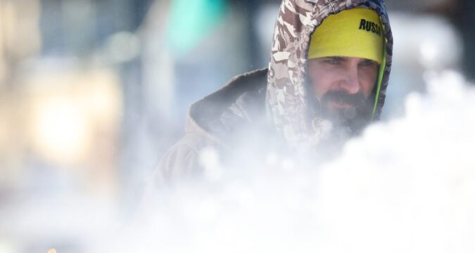
People walk along South Wacker Drive in the cold temperatures on Jan. 21, 2026, in Chicago. (Josh Boland/Chicago Tribune)
More than 200 warming centers will be open this week across Chicago, according to the city’s OEMC, including community service centers, senior centers, Chicago Public Library locations, Chicago Park District field houses and Chicago police stations during operating hours.
Over the weekend, Garfield Community Service Center will remain open from 9 a.m. to 8 p.m. as well as Public Library, Park District and Police district locations.
To find the closest warming center and hours, Chicagoans are encouraged to call 311 or download the CHI311 app.
Cook County’s Department of Emergency Management and Regional Security is also opening warming centers at the Skokie, Maywood and Markham courthouses starting at 8:30 a.m. Thursday through 4:30 p.m. Monday.
A full list of Cook County warming centers can be found here or by calling 211.
Metra will be operating reduced train schedules Friday because of the severe cold forecast. Travel times may also increase due to Metra speed restrictions during subzero temperature conditions.
https://www.chicagotribune.com/2026/01/22/polar-vortex-chicago-arctic-subzero/